Glossary of Globe Terminology | How to Read & Understand Your World Globe
An extended and updated glossary of globe terminology. Everything you need to know to understand the wording used in relation to world globes, from antique and vintage globes throughout history – to high quality traditionally handcrafted and hand painted world globes like ours. This should hopefully help you better understand your globe and the references you see elsewhere on our website. Anything you think we are missing? Let us know!
Analemma
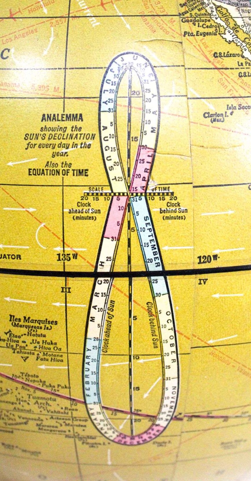
An analemma on a globe is a figure-eight-shaped diagram, usually designed in to an empty space in the ocean. Often these days more decorative than widely used, it shows the position of the sun at the same time of day throughout the year and is a fun addition to any traditional globe.
What the Diagram Shows
• North-South Position (Latitude): The vertical height on the figure-eight shows the latitude where the sun is directly overhead (at its zenith) at local noon for any given day of the year. The top and bottom loops align with the Tropics of Cancer and Capricorn.
• East-West Position (Equation of Time): The horizontal width shows the equation of time, which tells you how much faster or slower your regular clock is compared to true solar time on a specific day.
 Why It Is Shaped Like a Figure Eight
• Earth’s Axial Tilt: The 23.5-degree tilt of the Earth creates the vertical north-to-south movement of the sun over the seasons.
• Earth’s Elliptical Orbit: The slightly oval shape of Earth’s orbit and its changing speed as it moves around the sun cause the sideways, asymmetrical widening of the figure-eight.
To use an Analemma on a globe, find your specific date on the loop, and read across to the latitude scale to see where the sun is directly overhead at noon.
Follow a horizontal line straight across from that date to the globe’s nearest degree markings on the meridians or equator. This tells you the latitude where the sun hits the Earth at a 90-degree angle (the subsolar point) on that day. For example, the sun is directly over the equator around March 21 and September 23, over the Tropic of Cancer (23.5° N) around June 21, and over the Tropic of Capricorn (23.5° S) around December 21.
Calculating Sun Angle (Solar Altitude)
• Find your latitude: Note the latitude of your current location on the globe.
• Get the solar declination (D): Use the analemma to find the declination (latitude of the sun) for your chosen date.
• Do the math: Subtract your latitude from 90 degrees, then add or subtract the sun’s declination depending on whether you are in the same or opposite hemisphere as the sun (90° – Latitude ± D) to find how high the noon sun is above your horizon.
Pictured above : 1967 Cram’s Scope-O-Sphere 12″ World Globe Map with Analemma. Note the poor construction of this globe, you can see the grid (lines) do not match up on the right side.
Armillary Sphere
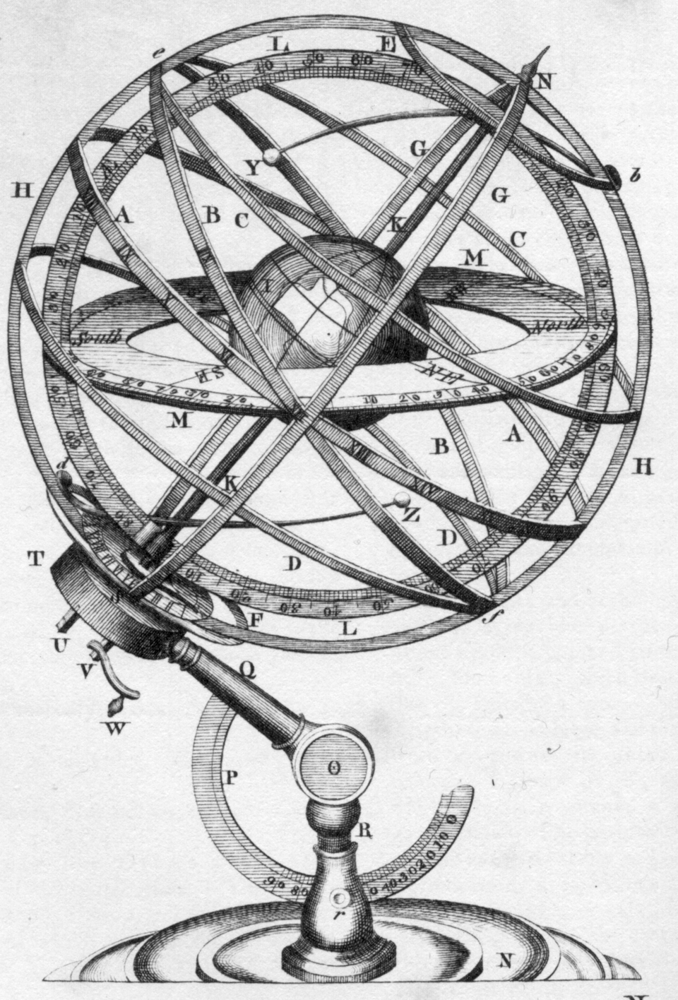 An armillary sphere is a historical model of the objects in the sky, made of a skeletal framework of interlocking metal rings that represent the lines of the celestial coordinate system.
Key Components
• Center: A small ball or sphere representing either the Earth (in older geocentric models) or the Sun (in later heliocentric models).
• Rings (Armillae): Derived from the Latin word armilla, meaning bracelet or ring, these bands represent important celestial lines like the equator, the zodiac, meridians, and the tropics.
• Ecliptic: A tilted ring that shows the apparent yearly path of the sun across the sky.
Invented independently in ancient China (as early as the 4th century BC) and ancient Greece (by the 3rd century BC). They were used by early astronomers like Ptolemy to track star positions, calculate coordinates, and tell time or determine sunrise and sunset times. Later evolved into symbols of wisdom and luxury, frequently placed in European libraries, observatories, and formal gardens as sophisticated sundial armillary spheres.
Artisan
An artisan is a skilled worker who makes items by hand or using traditional methods, focusing on quality and detail rather than mass production.
Artisans are trained in a practical trade or craft (such as a baker, potter, or carpenter) and create functional or decorative goods – like globes!
Artisans rely on mastered techniques passed down through time rather than factory assembly lines. Production happens in small workshops or batches rather than mass quantities
Axis
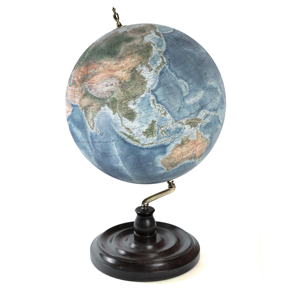 The axis is the physical rod or shaft running through the centre of a globe that holds the sphere in place and allows it to spin.
You will see this on our Livingstone globe and our Traditional Floor Standing styles. Though on our traditional floor standing globes you can move the axis to spin the globe from any angle or even view it upside down.
What the Axis Represents
• The Real Earth’s Rotation: It represents the imaginary line around which the real planet Earth rotates from west to east.
• The Geographic Poles: The top end of the axis represents the North Pole, and the bottom end represents the South Pole.
• The Tilt: The axis on a standard globe is mounted at an angle—specifically a 23.5-degree tilt—which mimics the real Earth’s axial tilt relative to its orbital plane around the Sun. This tilt is what creates our changing seasons.
Pictured is our 36cm diameter
Livingstone in Deep Ocean Gagarin with a Dark London Plane Wood base.
Bespoke
An adjective for anything commissioned to a particular specification. It may be altered or tailored to the customs, tastes, or usage of an individual purchaser. For example we say our globes are bespoke as we work with each client one-on-one to design their globes exactly as they would like it, and each is one-of-a-kind.
Cast
Impression formed when a liquid substance is poured into a form or mould, and then hardens into that shape.
We often use lost-wax casting — also known as investment casting or cire perdue — it is a metal-forming technique where a wax model is encased in a mould, melted out with heat, and replaced with molten metal to create a precise duplicate.
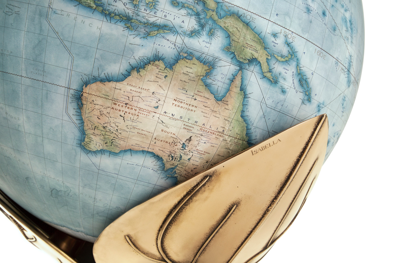
An artist shapes the exact design using wax or carving tools. The wax model is covered in a liquid plaster or ceramic slurry that hardens into a solid shell. You then need to burn out the wax. The hardened muold goes into a hot kiln. The heat melts and burns away the wax completely, leaving a hollow negative space.
The hot liquid metals such as gold, silver, bronze, or brass—is poured or spun into the empty cavity.
After the metal cools, the outer shell is broken away or washed off. The metal piece is then cut, ground, and polished smooth.
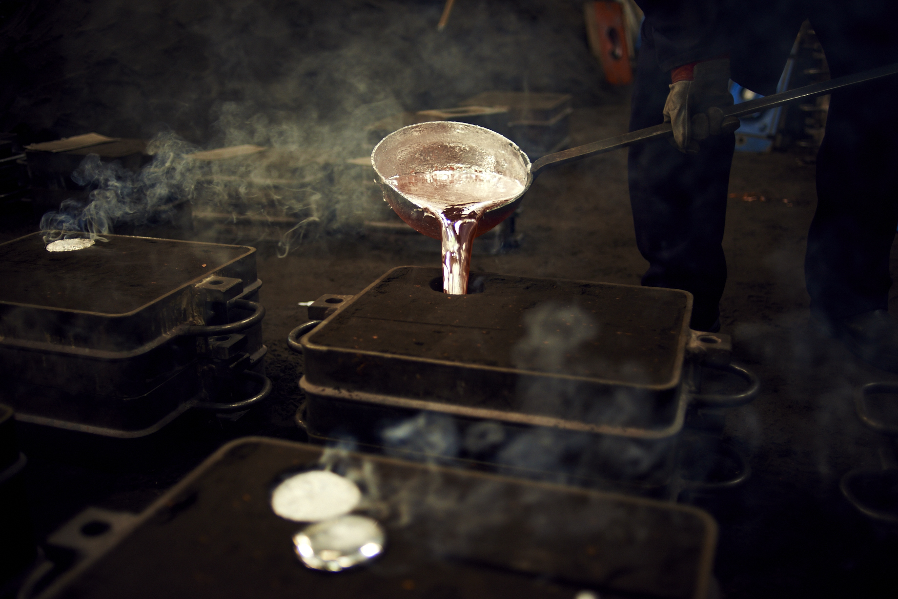
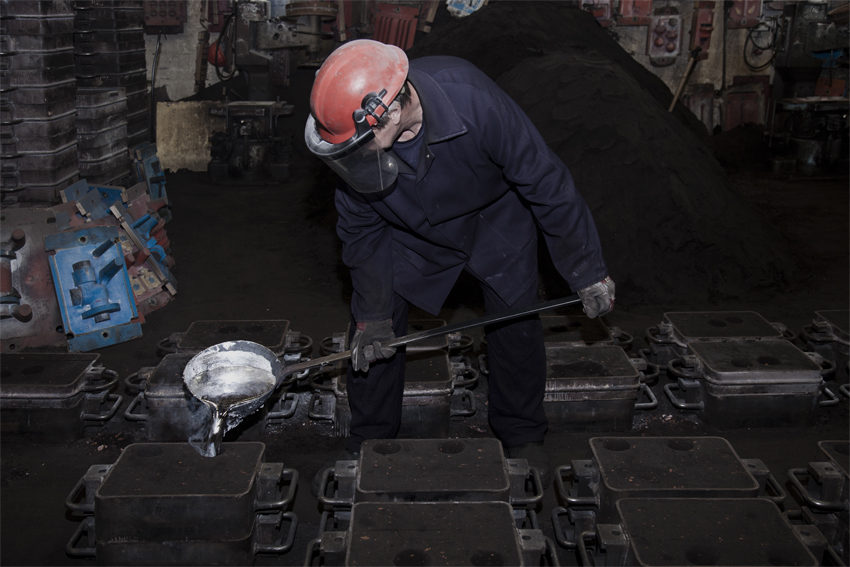
Pictured above is a one-off metal base for a globe we made using the lost wax method, below is one of our bases being made in the foundry (photos by Hal Shinnie & Ana Santl).
Calotte (Polar Calottes)
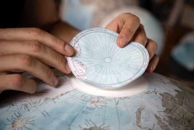
Polar calottes on a globe are two round pieces of printed paper that cover the North and South poles.
They include polar projections, exploration routes on some of our bespoke or themed globes, or artistic decorations specific to the Arctic and Antarctic regions.
In our process, applying the top and bottom calottes is one of the final steps before the sphere is sealed and mounted onto its base.
Photo of us applying a polar calotte to the top of a large globe, photo by Justin Ratcliffe.
Cartouche
A cartouche on a globe is a decorative framed emblem or box that contains key information, such as the map’s title, the maker or publisher’s name, the date of publication, or a dedication. In many of our cases they are designed for a client around their interests, passions, the theme of their personalisation on the globe, or a message they want to be the focus on the globe.
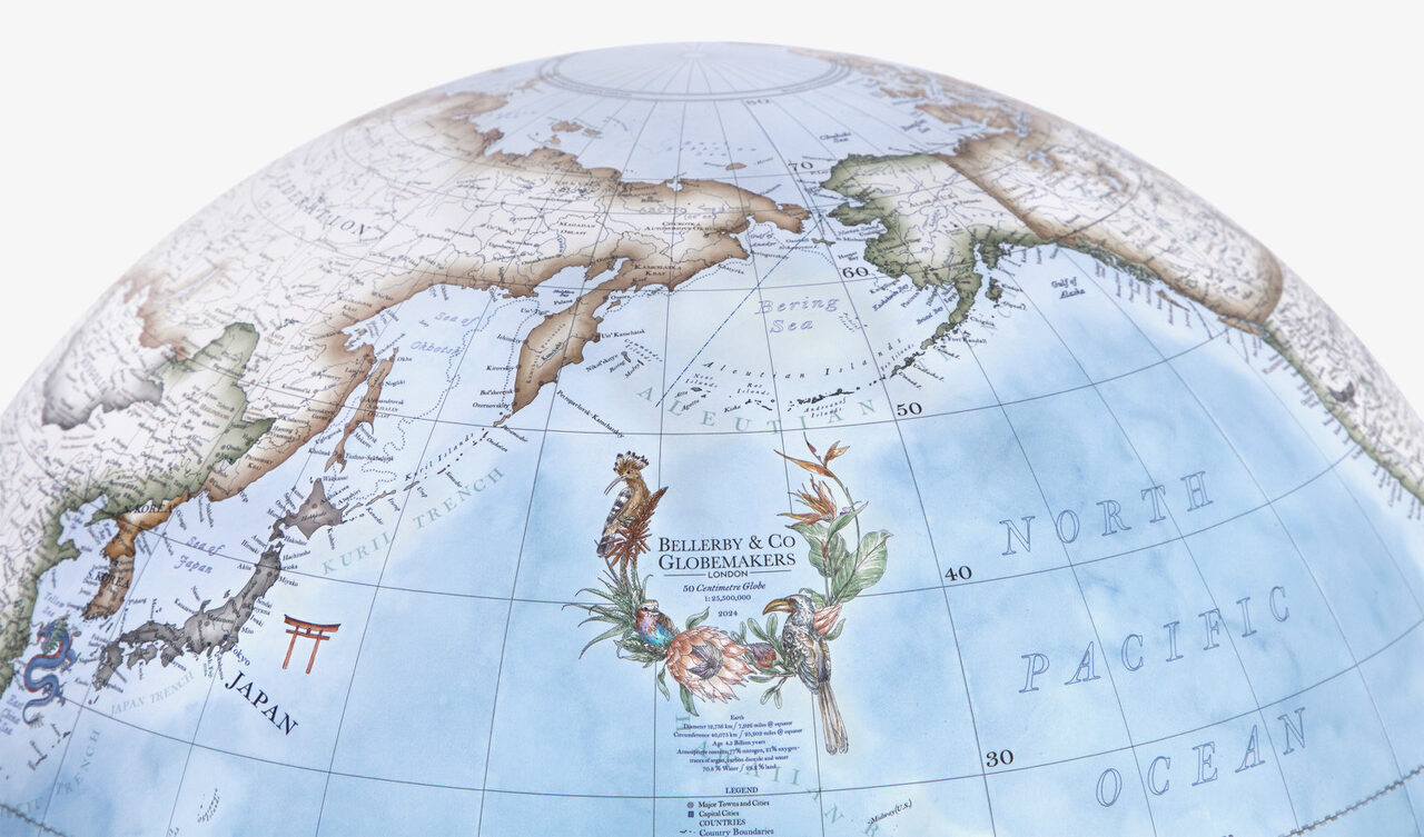
The features can include an ornate frame style like a scroll, shield, or crest, often surrounded by artistic or architectural flourishes. We have done flowers, animals, sports, monuments, family portraits, pets and everything in between!
It is a really nice way to add an extra artistic touch to the globe.
Often clients have us add names, dates, dedications, quotes or family history within the middle.
In antique cartography, mapmakers sometimes used large cartouches to cover and hide uncharted or unknown regions on the globe.
Pictured is a clients bespoke cartouche, hand drawn and hand painted to their specifications and placed ab0ove the legend of the globe. In this case they wanted it to surround our own company detail, the sizing of the globe, the year the globe was made and the scale.
Celestial Globe
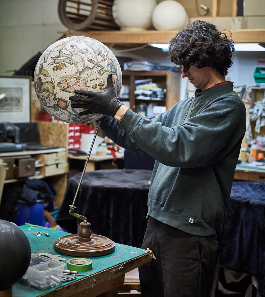
A celestial globe is a spherical three-dimensional model that maps the visible stars, constellations, and coordinate systems of the night sky onto the imaginary surface of the celestial sphere.
Unlike a terrestrial globe (which shows the Earth from the outside looking at continents), a celestial globe represents the heavens. It places an imaginary Earth at the centre and displays the stars as they would appear if viewed from that centre point, though mapped onto the outside of the ball.
Key Features
• The Celestial Sphere: An imaginary giant shell surrounding the Earth where stars are fixed.
• Equator and Poles: The Earth’s equator and rotational poles extend outward into space to form the celestial equator and celestial poles.
• The Ecliptic: A ring marking the apparent path of the Sun across the sky over the course of a year.
• Coordinate Rings: Most are mounted in a brass or metal ring (the meridian) and set inside a horizon ring, which can be tilted to match the user’s geographic latitude.
Uses and History >>
Education and Navigation: They served as tools to teach star identification and celestial navigation before the widespread use of modern digital software.
Ancient Roots: Dating back to antiquity—such as the ancient Greek
Farnese Globe—these instruments reached high levels of artistic and technical craftsmanship during the Islamic Golden Age and the European Renaissance.
Cradle Mount
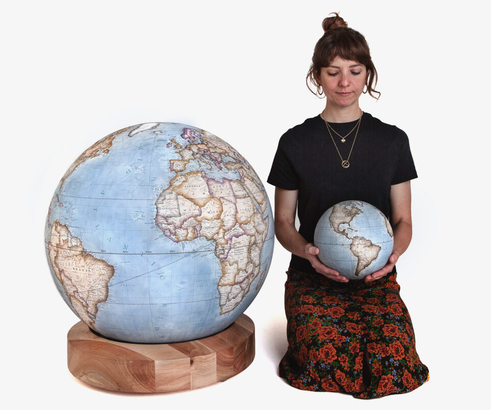 A cradle mount on a world globe is a supportive ring, fork, or cradle-like base where the globe rests, allowing the sphere or its meridian ring to rotate freely and often be lifted out entirely – like our ever-popular Albion bases.
This modern style of mounting a globe in a cradle is great for close-up viewing or hand-held study. And our bases allow for 360 movement on semi-hidden ball bearings in all directions and great big long spins.
The alternative is the fixed-axis or semi-meridian mounts that permanently lock the Earth at its precise 23.5-degree axial tilt.
Degree
On a globe, a degree is a unit of measurement used to determine absolute location by measuring the angles from the Earth’s centre.
One degree (°) represents 1/360th of a full circle around the Earth. These degrees are used in two grid systems to pinpoint any exact spot on the planet:
Latitude (Parallels): These lines run east-west and measure distances north or south of the Equator (0°). They range from 0° at the Equator to 90° at the North and South Poles.
Longitude (Meridians): These lines run north-south from pole to pole and measure distances east or west of the Prime Meridian (0° in Greenwich, England). They range from 0° to 180° east or west.
Breaking Down a Degree >>>
Because the Earth is so large, a single degree covers a massive distance—roughly 69 miles (111 kilometers). To pinpoint exact locations (like a specific building), degrees are broken down into smaller fractional units based on the number 60…
Minutes: Each degree is divided into 60 minutes (‘). One minute of latitude is about 1.15 miles (1.85 km).
Seconds: Each minute is further divided into 60 seconds (“). One second of latitude is about 100 feet (30 meters).
Diameter
The diameter of a globe is the straight-line distance passing directly through its centre from one edge of the sphere to the opposite edge.
Globemakers like us use the Diameter of Globes to state the physical size of the orb – for example our Pocket globes are 12cm diameter and our medium desktop globes are 36cm diameter.
A larger diameter means more surface area, which allows the globe to display smaller text, more cities, and finer geographical boundaries.
The diameter is always equal to twice the length of the radius (the distance from the center to the surface).
Erdapfel
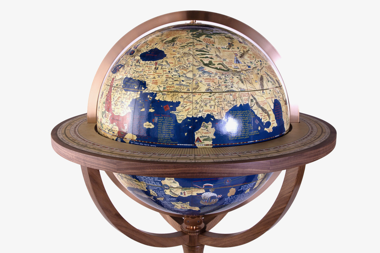 The Erdapfel (German for “earth apple”) is the oldest surviving terrestrial globe in the world.
Built by German merchant, navigator, and geographer Martin Behaim between 1490 and 1492.
Commissioned by the city council of Nuremberg, Germany, where it is now preserved in the Germanisches Nationalmuseum.
This globe was made from a laminated linen ball reinforced with wood and plaster, then overlaid with a map painted by artist Georg Glockendon. It measured 51 centimeters (21 inches) in diameter.
Fun facts.. it omitted the Americas entirely because it was completed just before Christopher Columbus returned from his first voyage.
And it features an enlarged Eurasian continent, an oversized and misplaced Japan (Cipangu), an empty ocean separating Europe and Asia, and mythical locations like Saint Brendan’s Island.
The globe is decorated with over 100 hand-painted illustrations, including animals, royal figures, flags, and mythical creatures.
This globe was admitted to the UNESCO Memory of the World Register in 2023.
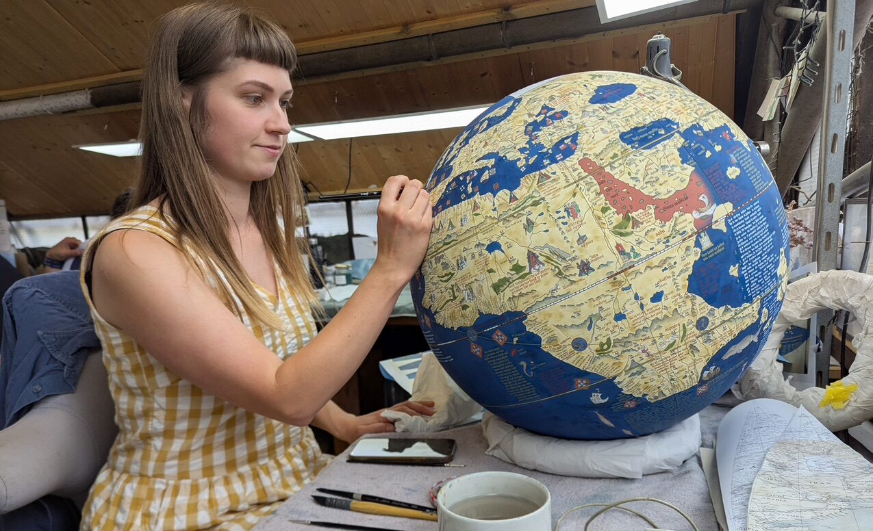
Pictured above and below : our rendition of The Erdapfel, a bespoke commission for a private client in 50cm diameter.
See more images here.
Eastern Hemisphere
The half of the Earth generally recognised as being composed of Europe, Africa, Asia, Australia, and their nearby oceans.
Equator
The Equator on a globe is the line that circles the middle of the earth at 0 degrees latitude.
It splits the globe into two equal parts: the Northern Hemisphere (top half) and the Southern Hemisphere (bottom half).
The Equator is the starting point (0°) for measuring latitude, which tells us how far north or south a place is.
It is the longest line of latitude on the globe, measuring about 24,900 miles (40,000 kilometers) around.
The equator passes through 13 countries across South America, Africa, Asia, and Oceania.
Ecuador (including the Galápagos Islands), Colombia, Brazil, São Tomé and Príncipe (crosses the islet of Ilhéu das Rolas), Gabon, Republic of the Congo, Democratic Republic of the Congo, Uganda, Kenya, Somalia, The Maldives (passes through its territorial waters/atolls rather than major land), Indonesia (crosses multiple islands like Sumatra and Borneo) and Kiribati (passes through its ocean/island waters).
Pictured : the equator on one of our 127cm (50 inch) diameter
Churchill globe.
Equatorial Band
An equatorial band on a physical world globe is a physical strip or tape applied directly around the equator to cover and protect the manufacturing seam where the two halves of a machine-pressed globe meet.
It has been used by some Globemakers in the past and in the present to hide the paper or plastic seam running along the 0° latitude line. They use it to prevent the edges of the printed map (or gores) from peeling or fraying at the equator.
It is sometimes printed with latitude markings, degrees, or decorative lines that align with the globe’s grid.
We do not use these on our globes.
Equinoxes
On a physical world globe, the equinoxes are represented by the two exact points where the equator intersects the ecliptic line.
Here is how you can find and understand them on a standard globe:
To find the equinoxes, you need to locate two specific lines printed on the globe’s surface:
• The Equator: The horizontal line running around the exact middle of the globe, dividing it into the Northern and Southern Hemispheres.
• The Ecliptic Line: A diagonal, graduated circle that rings around the globe at an angle. It represents the apparent path of the Sun across the sky over the course of a year.
Locating the Equinox Points
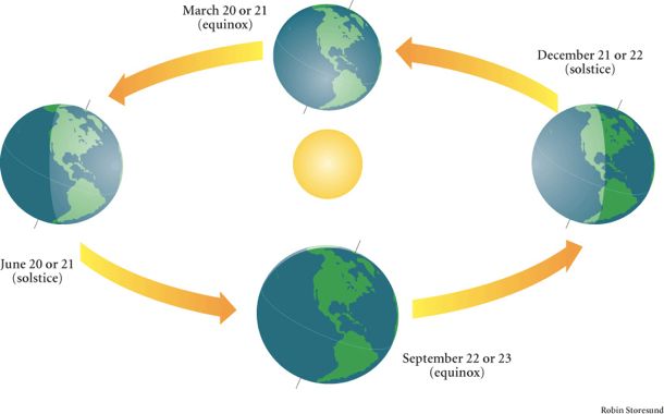
Because the ecliptic line is tilted at an angle of 23.5 degrees relative to the equator, the two lines cross each other at exactly two places. These intersection points are the equinoxes:
• The Vernal (Spring) Equinox: This is the point where the ecliptic line crosses the equator moving from south to north. On most globes, this intersection point is located in the Atlantic Ocean, near the coast of West Africa. It marks the start of spring in the Northern Hemisphere (around March 21).
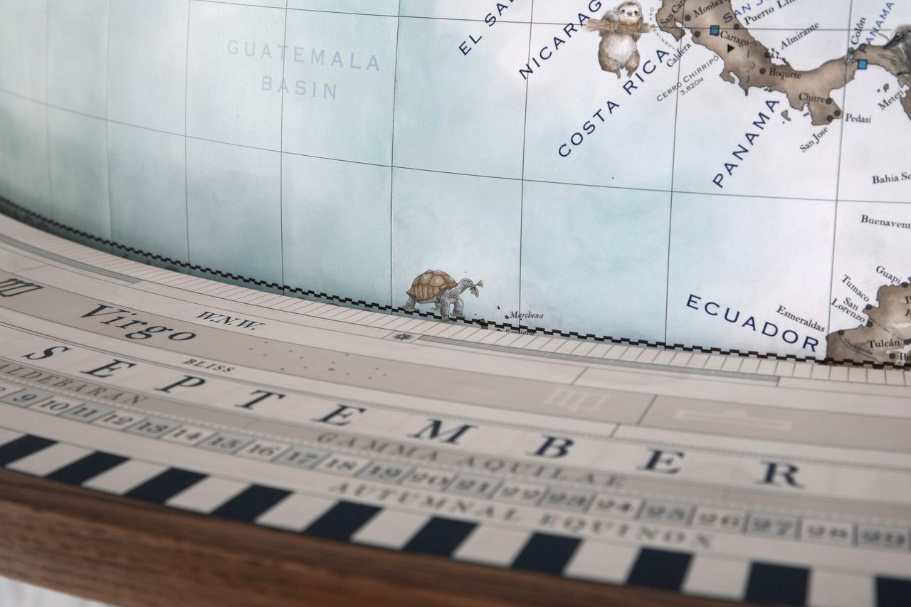
• The Autumnal (Autumn) Equinox: This is the point where the ecliptic line crosses the equator moving from north to south. On a globe, this point is typically located in the Pacific Ocean. It marks the start of autumn in the Northern Hemisphere (around September 22).
 The physical structure of the globe itself also demonstrates why equinoxes happen:
• The Tilt: A physical globe is mounted on a stand at a 23.5-degree angle to mimic Earth’s actual axial tilt in space.
• The Sun’s Position: During an equinox, if you imagine a light bulb representing the Sun sitting directly level with the center of the globe, the light would shine directly on the equator. Both the North and South Poles would be exactly on the borderline between the lit side and the dark side, meaning day and night are of equal length everywhere on Earth.
More specifically it refers to he two events of the year, often around March 21 and September 23, when the sun’s rays are perpendicular to the Equator, resulting in day and night being of equal length all over the world.
Pictured : the Autumnal Equinox marked on our globe (towards the upper right hand side)

Floor Standing Globe
 A floor standing globe is a large, freestanding world map mounted on a tall base that rests directly on the floor rather than on a desk or table.
The globe ball is usually much larger than a desktop model, ours start at 50cm (20 inch) diameter and go up to 65cm, 80cm, 110cm, 127cm (50 inches) and 152cm diameter (60 inches).
Our bases are all handcrafted in the clients choice of wood or metal.
What is a World Globe?
 A world globe is a three-dimensional, spherical scale model of Earth.
Unlike flat maps, a globe does not distort the relative sizes, distances, or shapes of continents and oceans.
It features a network of latitude (horizontal) and longitude (vertical) lines to pinpoint exact geographical coordinates.
Some globes are mounted at a ~23.5-degree tilt to replicate Earth’s actual rotational axis and demonstrate seasonal changes.
They can be
political (showing country borders and capitals) or
physical (showing mountains, deserts, and water bodies) – or anything in between. We work with clients to design their globes exactly as they would like it.
Globes are used in classrooms to teach global awareness and spatial relationships. They help the viewer to visualise the shortest curved routes across the world. The also serve as a classic desk or shelf ornament for homes and offices, interior decoration, or works of art.
Greenwich Meridian (Prime Meridian)
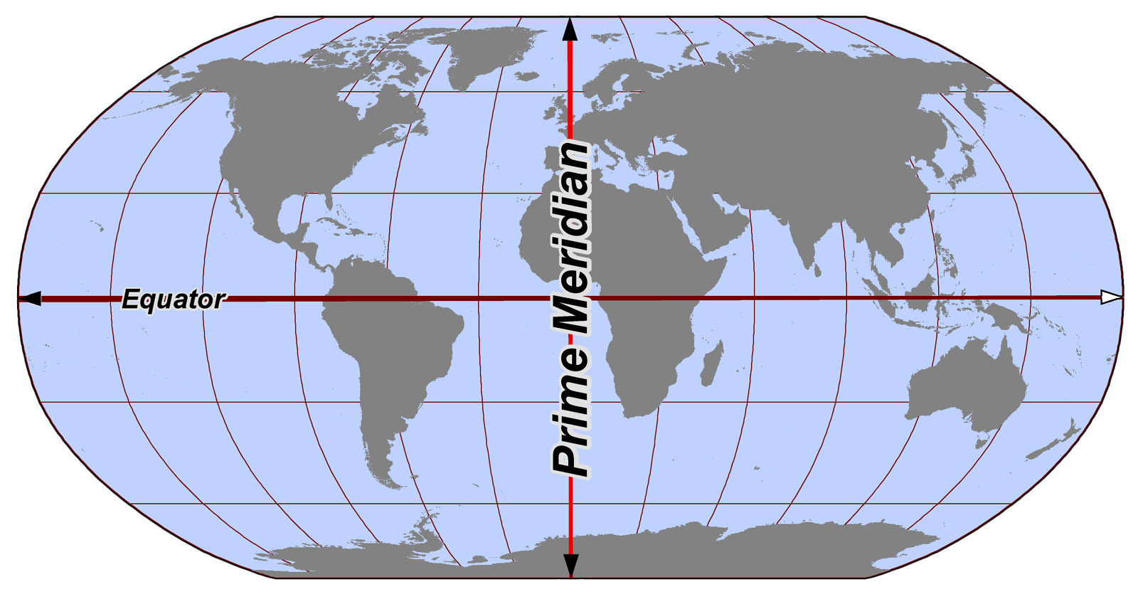
The Greenwich Meridian is an imaginary reference line at 0° longitude that runs from the North Pole to the South Pole through the Royal Observatory in Greenwich, London.
Divides Hemispheres: It splits the Earth into the Eastern Hemisphere and the Western Hemisphere, much like the equator splits the earth into northern and southern halves.
Measures Longitude: It serves as the starting point (0° 0′ 0″) from which all other angles of longitude are measured east or west.
Standardises Time: It is the foundational reference point for Greenwich Mean Time (GMT) and the global time zone system.
The Greenwich Meridian was officially chosen as the international standard Prime Meridian in October 1884 at the International Meridian Conference in Washington, D.C.. Its exact path is determined by the historic Airy Transit Circle telescope inside the Royal Observatory, Greenwich.
The line passes through the UK, France, Spain, Algeria, Mali, Burkina Faso, Togo, Ghana, and Antarctica.
Gore
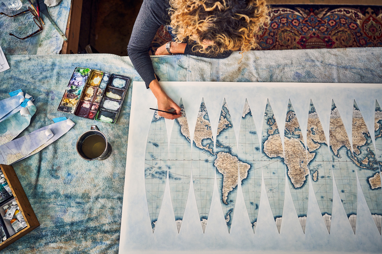
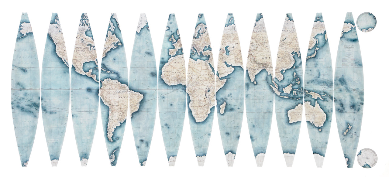
A gore is a tapered, lune-shaped (curved and pointed) strip of paper or map material that can be pasted onto a sphere to form a continuous 3D world globe.
Why Gores Are Used?
• Flattening the Earth: You cannot wrap a flat, continuous sheet of paper around a ball without tearing, wrinkling, or overlapping.
• Minimising Distortion: Cartographers divide the world map into long vertical slices (like sections of an orange) that stretch from pole to pole.
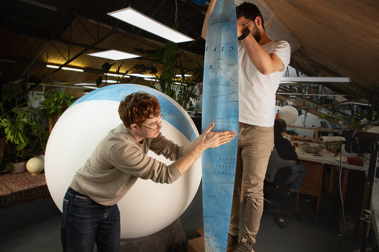
Most globes use 12 individual gores, each covering 30 degrees of longitude, paired with small round cap pieces (see : calottes) at the poles.
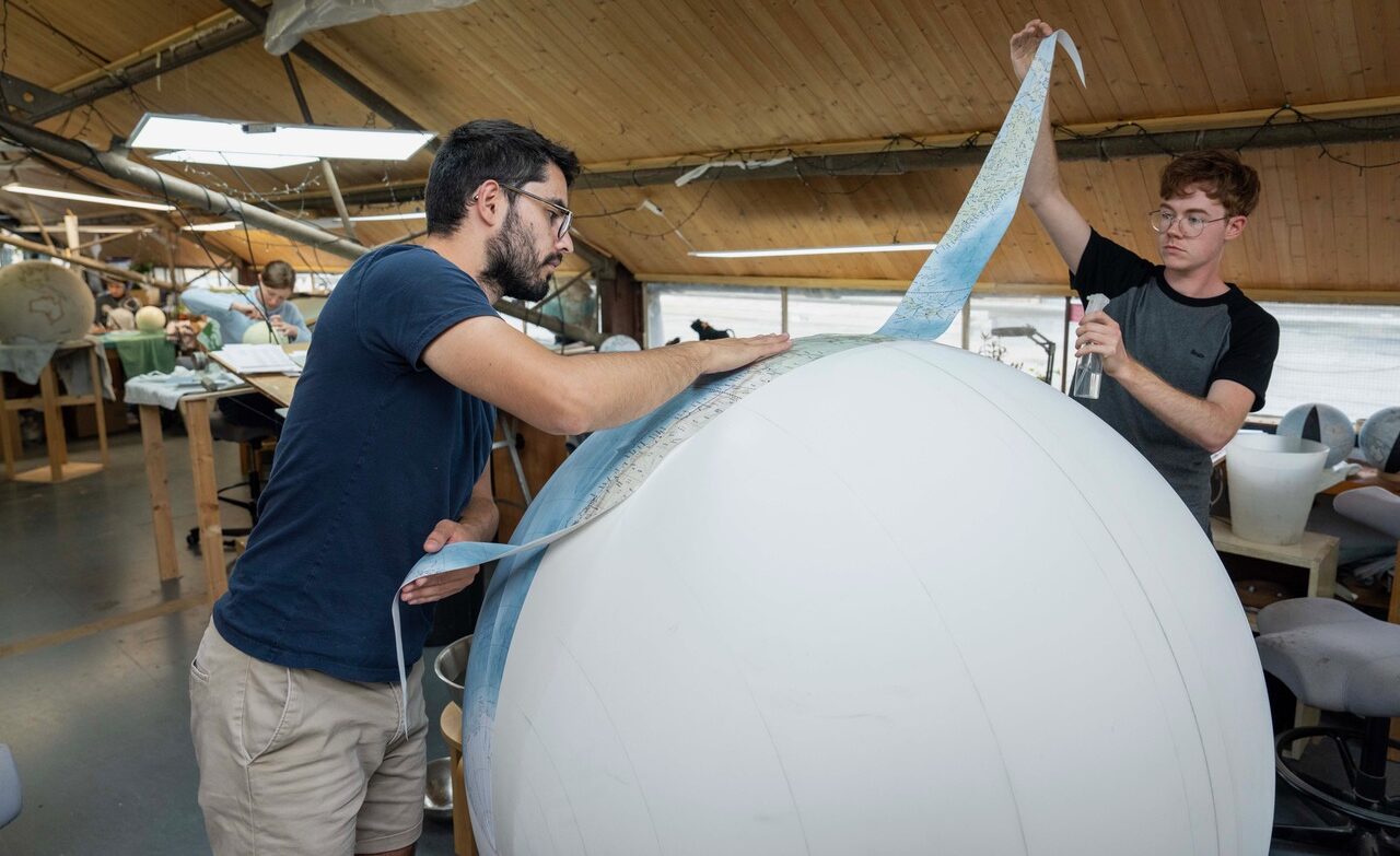
Pictured above :
1/ Two artisan Globemakers at Bellerby & Co wet and stretched a hand cut paper gore across a 127cm (50 inch) sphere of what will be a
large world globe. Photo by Philip Coburn.
Grid
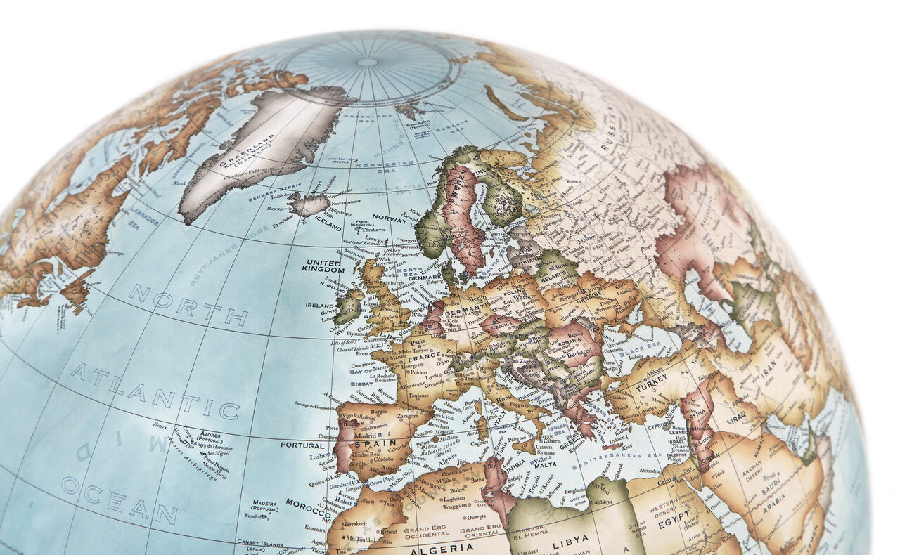 The grid on a world globe is a network of crossed lines made by horizontal lines of latitude and vertical lines of longitude.
• Latitude (Parallels): These lines run east-to-west and measure how far north or south a place is from the Equator (the middle line that splits the earth).
• Longitude (Meridians): These lines run north-to-south from the North Pole to the South Pole. They measure how far east or west a place is from the Prime Meridian (a starting line passing through Greenwich, England).
What the Grid Does
• When a latitude line and a longitude line cross, they create unique coordinates. You can use these numbers to find any exact location on Earth.
• Grids can also be used to show different time zones and climate zones (how hot or cold an area is).
Pictured : detail on a 36cm Pacific Blue Cassini globe where you can see the grid.
Hemisphere
A hemisphere on a world globe is half of the Earth’s surface, created by dividing the globe into two equal parts.
The word comes from Greek, where “hemi” means half and “sphere” means a round ball. On a world map or globe, geographers use imaginary lines to split the planet into four main hemispheres.
The Equator as mentioned is the imaginary line at 0° latitude that runs horizontally around the middle of the globe splits the planet into these two halves.
Northern Hemisphere: Everything north of the Equator. It holds most of the world’s land and about 90% of the human population, including North America, Europe, and most of Asia.
Southern Hemisphere: Everything south of the Equator. It contains Antarctica, Australia, and parts of South America and Africa, and is mostly covered by water.
The Prime Meridian: An imaginary line at 0° longitude that runs vertically from the North Pole to the South Pole (passing through Greenwich, London) splits the planet this way.
Western Hemisphere: Everything west of the Prime Meridian, which includes North and South America.
Eastern Hemisphere: Everything east of the Prime Meridian, which includes Europe, Asia, Africa, and Australia.
Horizon Band
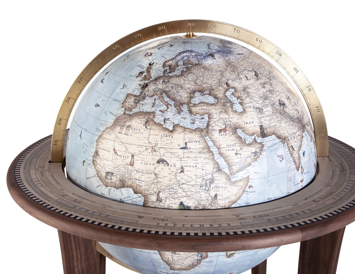
The horizon band on a world globe is the flat, circular ring or border surrounding the globe that represents the celestial horizon, visually dividing the sphere into upper and lower hemispheres. You see ours on the table top of our bases on our traditional bases for our larger globes – supporting the meridians that hold the globes.
It acts as an imaginary plane extending out from the observer to the sky, showing what part of the world is currently “above” or “below” the horizon.
Traditional or antique horizon bands are often marked with practical data, including calendar dates, signs of the zodiac, compass points, degrees, and hours.
Pictured below : a Glacial Blue
Animalia globe within a bronze meridian which sits within the horizon band or table top of the base surrounding the globe.
Illustration
A decoration, interpretation or visual explanation of a text, concept or process, designed for integration (in this case) into the cartography of a globe. We have illustrations of all sorts, from animals, the monuments, to portraits, to sea monsters, to ships. See above example.
Inclination of the Earth’s Axis
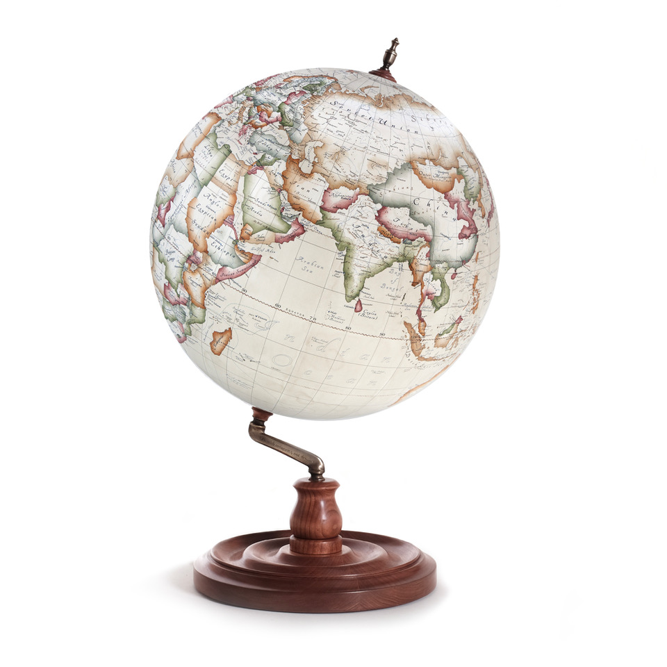
The tilt of the planet’s rotational axis (an imaginary line through the North and South Poles) relative to a line perpendicular to its orbital plane around the Sun.
This tilt changes how directly sunlight strikes different parts of the Earth throughout the year, creating summer and winter.
The angle is not completely fixed; over a 41,000-year cycle, it varies slightly between 22.1 degrees and 24.5 degrees.
Scientists believe a massive, Mars-sized body named Theia crashed into early Earth 4.5 billion years ago, setting the planet on its permanent tilt.
Pictured : a bespoke antique map on a Bellerby & Co Globemakers globe in the colouring Parchment Cassini, the Livingstone style base has the globe spinning on the axis.
International Colouring Scheme
The International Colouring Scheme (also known as the International Map of the World / hypsometric colour scheme) is a standardised system of contour layer colouring used in cartography to represent land elevations and water depths on globes and physical maps.
Instead of showing political borders, this scheme uses a progressive multi-hue palette to give viewers an instant, intuitive understanding of the Earth’s three-dimensional topography.
International Date Line
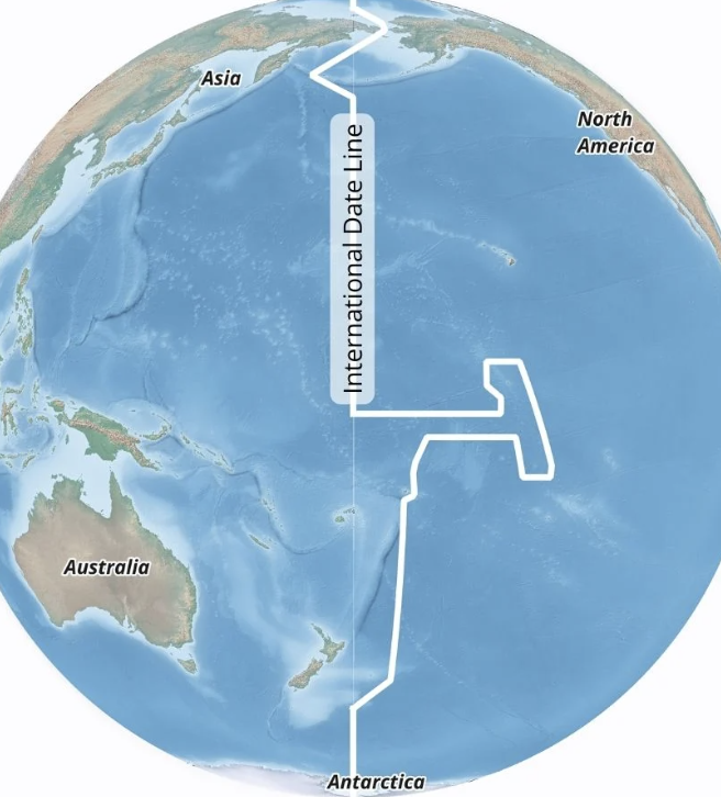 The International Date Line is an imaginary line from the North Pole to the South Pole in the Pacific Ocean that marks where one calendar day changes to the next.
It sits at roughly 180 degrees longitude, which is halfway around the world from the Prime Meridian in Greenwich, England.
The line is not straight. It curves and zigzags around political borders, island groups, and countries like Russia and Alaska.
The bends keep entire countries or island chains on the same calendar day for easier trade and communication.
When you cross the line going west, you add one calendar day (for example, changing Monday to Tuesday).
When you cross the line going east, you subtract one calendar day (changing Tuesday back to Monday).
The date line is a practical tool and a cartographic convention, meaning it has no formal status under international law.
We can design the date line on to our maps and globes by request, it is not on as standard.
Latitude & Longitude
Latitude and longitude form an imaginary grid system of lines on a globe that allows you to find the exact position of any place on Earth.
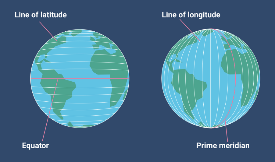
Imaginary horizontal lines circle the globe from east to west.
The Equator is 0° latitude. It splits the Earth into the Northern and Southern Hemispheres.
It is measured in degrees from 0° at the Equator up to 90°N at the North Pole and 90°S at the South Pole.
Latitude lines are always parallel and never meet.
Longitude lines are furthest apart at the Equator and meet (converge) at the poles. Image via time and date’s website.
Legend
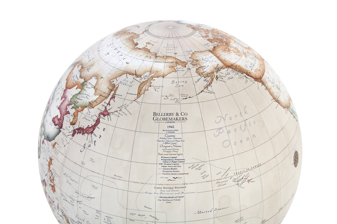
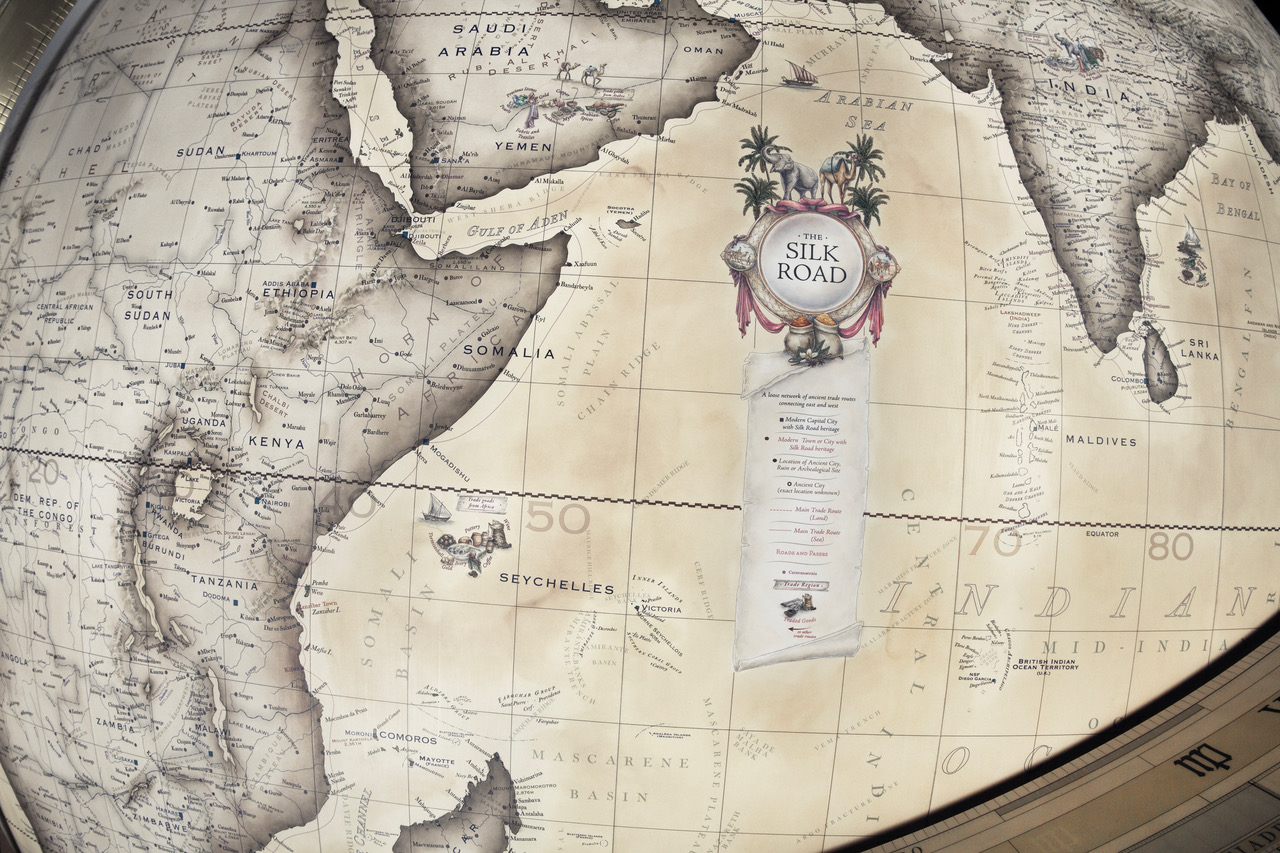
The legend on a globe is a key or chart that explains the meaning of the symbols, colours, and lines used on the surface.
For example identifying small icons or markers used for capital cities, major airports, shipping routes, or ocean trenches. We use them for clients personal travel routes as well or on themed globes when symbols are used.
The legend will also specify markings like international borders, latitude and longitude grid lines, or ocean current paths that may be a part of the mapping.
Examples of Bellerby & Co Globes below include :
– a special globe designed to show the world in 1942 and the legend details key ways to read the map.
– a legend for the Silk Road themed globes we make.
– a legend for travel routes and trade winds on a bespoke map.
Martin Behaim
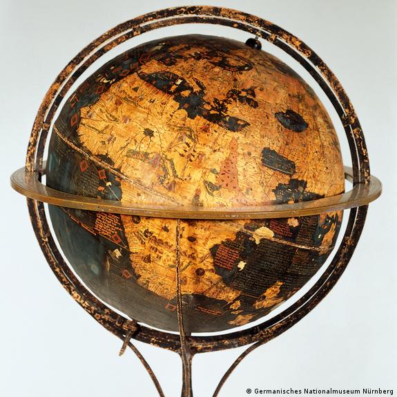 Martin Behaim (1459–1507) was a German merchant and cartographer who created the Erdapfel, the world’s oldest surviving terrestrial globe mentioned above.
Apart from this he served King John II of Portugal as an adviser on navigation and mathematics. He participated in an expedition down the west coast of Africa with explorer Diogo Cão – and he is often credited with helping introduce or promote the use of improved navigational tools, such as the brass astrolabe and cross-staff, in Portuguese maritime exploration.
Scroll back up to Erdapfel for images and links to the Bellerby & Co Globemakers Erdapfel commission.
Meridian (Half Meridian / Full Meridian)
A metal meridian on a world globe is the circular or semi-circular metal band that encircles the globe ball, attaching to it at the North and South poles to mount it to the stand.
It holds the globe sphere firmly in place.
Our meridians are made from solid Bronze or Brass and hand engraved with degree numbers running from 0° at the equator to 90° at the poles to help measure latitude.
We use full meridians (a complete 360-degree circle). While historically used for navigation and calculating coordinates, they are now often valued for its classic structural and decorative look.

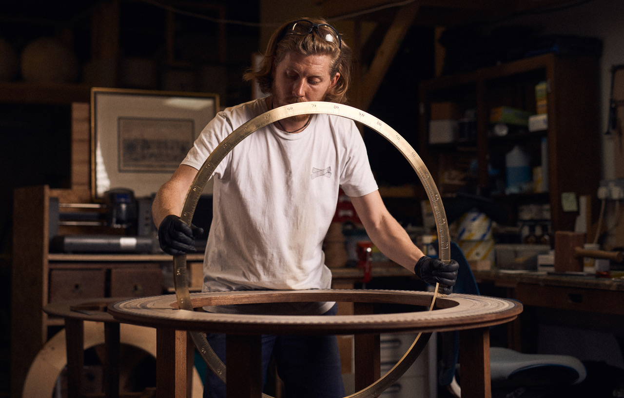
Pictured : a Bellerby & Co Globemakers large traditional Mint Green globe with a solid Bronze hand engraved meridian and in our Globe-making workshop fitting a meridian to its base – photo by Toby Essex.
Mounting
The structure to which the globe is attached to and is what keeps the globe in place. See the definition of the many types of mounts (Plain Mount, Cradle Mount, Stationary Mount).
New World
The “New World” on a historical map refers to the Americas and Oceania.
An early 16th-century term coined during the Age of Discovery to describe the Western Hemisphere (North and South America), separating it from the “Old World” of Europe, Asia, and Africa.
Early maps from explorers like Amerigo Vespucci and cartographers like Sebastian Münster added these western continents once Europeans realised they were separate landmasses rather than eastern Asia.
The United Nations “New World Map” (2026)
This is different from the the recent news of the UN General Assembly voting to phase out the 16th-century Mercator map projection in favour of the 2018 Equal Earth projection.
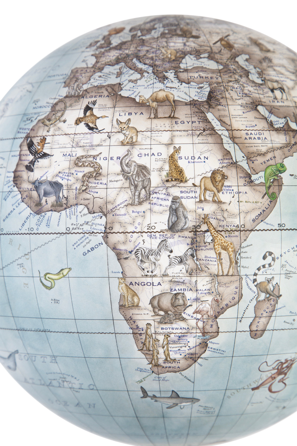
The Equal Earth map (this is FLAT WORLD MAPS and not 3d world globes) corrects the geographic distortion of the Mercator map, which shrinks regions near the equator and enlarges northern areas like Greenland and North America.
On this new 2d flat map, Africa, Latin America, South Asia, and Oceania appear much larger and closer to their true relative scale, while Europe and North America look smaller.
Is Africa the correct size on our globes? Of course it is. Globes have accurate proportions because they are three-dimensional (3d) models that match the true round, spherical shape of the Earth.
We work in gores.
Gores are the long, curved, pointed strips of paper (resembling an orange slice or surfboard) that you see in our studio. Each “slice” contains a section of the world map.By slicing a global map into multiple vertical segments (gores) running from pole to pole along lines of longitude, each individual strip can lie flat on a table yet fit seamlessly onto a round surface.You cannot stretch a round object (a 3d world globe) on to a flat piece of paper without tearing, stretching, or shrinking some parts.Flat maps use tricks called “projections” that force a sphere onto a 2D surface, which messes up either the size, shape, distance, or direction of landmasses.Common flat maps (like the Mercator projection) make areas near the top and bottom of the world—such as Greenland—look huge, while places near the middle look smaller than they really are.While maps face these projection dilemmas, a world globe like the ones we make – share the exact same 3D geometry as the planet it represents (Earth!) Distances, directions, shapes, and land sizes all keep a uniform ratio to the real world.No projection is needed for a world globe – because a globe does not need to be flattened, it avoids the mathematical distortion that ruins the proportions of flat world maps.
Northern Hemisphere
The Northern Hemisphere is the half of Earth that lies north of the Equator.
It runs from the Equator (0° latitude) up to the North Pole (90°N latitude). It holds most of Earth’s landmass and about 90% of the human population.
It contains all of North America, Europe, and Asia, plus about two-thirds of Africa and a small part of South America.
Summer runs from June to September, and winter runs from December to March, which is the opposite of the Southern Hemisphere.
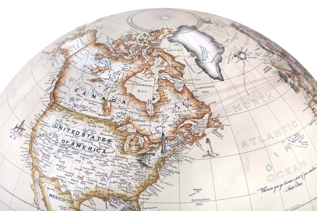
Pictured : a 36cm desktop globe showing the United States of America, Canada, Greenland and looking towards Europe – hand painted in Bellerby & Co Globemakers “Parchment Cassini” with added illustrations, travel routes, bespoke cartography, and dedications. Each globe is unique to the clients requests.
Oblate Spheroid
Now you say but Earth is not even round, it is an oblate spheroid. Or you are thinking what is an Oblate Spheroid. It is the three-dimensional shape of Earth at scale – like a sphere that is squashed at the poles and wide at the equator.
When considering world globes which are accurate representations of Earth, you might be worried they should not actually be spheres. However we are making world globes at a smaller scale than our actual Earth. If the Earth were shrunken down to a globe with an equatorial diameter of 50cm (a medium sized globe), it would be extremely round and smoother than a standard bowling ball. The distortion would be invisible to the naked eye.
Orb
An orb in terms of a world globe is simply another word for the round ball or sphere – same as a “world globe”
It refers to the physical spherical body itself rather than the stand, meridian ring, or other mounting hardware.
While most people just say “ball” or “sphere,” the term orb might be used in globe terminology, technical descriptions, or literature to emphasise its round, planetary shape.
Overlay
On some antique globes you might see that a label has been applied to cover the original cartouche. You will not see this on modern handcrafted and hand painted globes like ours.
Parallels of Latitude
Parallels of latitude are imaginary horizontal lines on a globe that run east to west and measure how far north or south a place is from the Equator.
They circle the globe completely, staying parallel to each other and never touching.
The Equator (0°): This is the main and longest line of latitude. It splits the Earth into the Northern and Southern Hemispheres.
They range from 0° at the Equator up to 90°N at the North Pole and 90°S at the South Pole.
The circles get smaller as they move away from the Equator and get closer to the poles.
Five Major Parallels
• Equator: 0°
• Tropic of Cancer: 23.5°N
• Tropic of Capricorn: 23.5°S
• Arctic Circle: 66.5°N
• Antarctic Circle: 66.5°S
Plain Mount
A globe mounted onto its base with no form of meridian present (see Meridian above).
Prime Meridian
See “Greenwich Time” above.
Projection (Flat Map Projections)
See above ~ the United Nations “New World Map” (2026)
A map projection is a mathematical method used to flatten the curved, three-dimensional surface of the Earth onto a two-dimensional flat surface like paper or a screen.
You cannot flatten a 3D sphere (a globe) on to a 2D plane without tearing, stretching, or shrinking some part of it—much like trying to flatten an orange peel.
Because perfect representation is impossible, every map projection (on a flat map – not a globe) distorts at least one or more key properties: area, shape, distance, or direction.
 Map projections are commonly categorised by the geometric shape used to project the surface:
• Cylindrical: Formed by wrapping a cylinder around the globe. They work well for the entire world or regions near the equator, such as the Mercator Projection.
• Conic: Formed by placing a cone over the globe. They work best for mid-latitude regions with a wide east-west spread.
• Azimuthal (Planar): Formed by projecting the Earth onto a flat plane touching a single point. They work best for polar regions.
Pictured : Above : Bellerby & Co Globemakers bespoke commission for a world map projection. Below : the world as it is in gores (the strips of map used to make a globe), this was a commission to also be framed on a wall with correct proportions.
Roller Bearings
Roller bearings on globes are small, cylindrical mechanical components placed inside the mounting mechanism (where the globe connects to its stand on our globes) to ensure the globe spins smoothly with minimal effort.
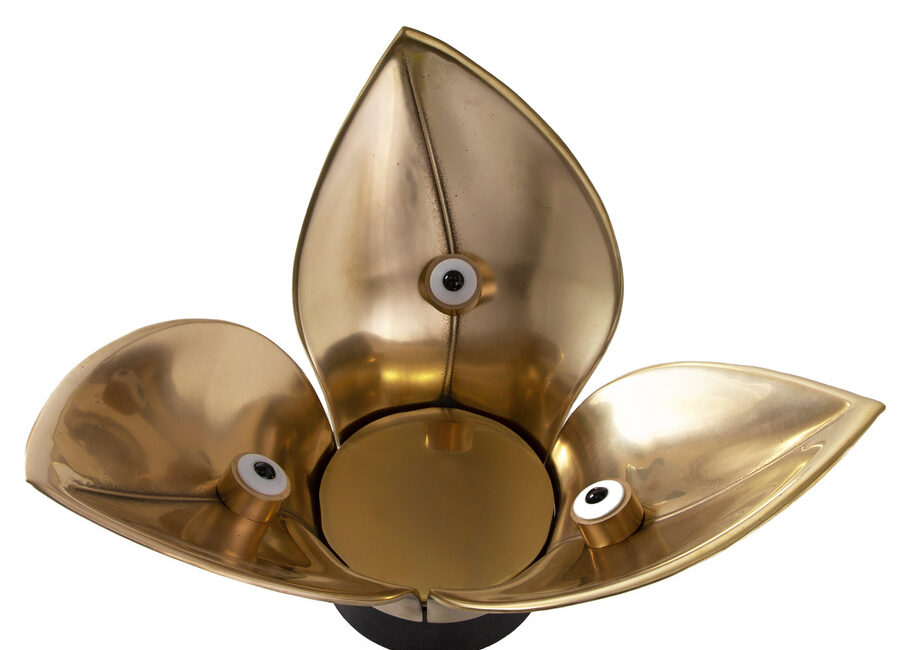
While simple (factory mad or mass produced) ornamental globes often use basic plastic sleeves or static pins (plain bearings), many of our globes feature industrial-grade rolling components to handle the weight.
Roller bearings change sliding friction into rolling friction. Instead of the metal axis scraping directly against the stand, the axis rolls over small internal metal cylinders. This lets you spin even a heavy floor globe with the touch of a single finger.
Standard ball bearings have “point contact” and can deform or jam under continuous heavy downward force. Roller bearings like ours feature “line contact,” distributing the globe’s weight evenly across a broader surface area.
Pictured above : semi-hidden roller bearings in a bespoke “petal” bronze base for a globe designed and handcrafted by Bellerby & Co Globemakers.
Rotation
The physical ability of the sphere (globe) to spin smoothly on its central axis, allowing you to turn the globe by hand to view different parts of the world.

• The Axis: An imaginary or physical rod passing through the North and South poles that serves as the central pivot point for the sphere.
• The Meridian: A half or full metal ring (often brass or steel) that holds the globe at its poles, allowing the sphere to rotate 360 degrees.
• Axial Tilt: Handcrafted floor and desk models are frequently mounted at a 23.5-degree angle to match Earth’s real tilt relative to its orbit so they might rotate only at the angle.
• Balance and Weight: Because artisanal globes are often made of plaster, resin, or hand-applied paper gores, makers must balance the sphere precisely inside the meridian so it spins evenly without wobbling or sticking.
Real Earth’s rotation takes 24 hours to finish one full spin, which gives us our cycle of day and night.
Pictured : Bellerby & Co Globemakers 127cm (50 inch) diameter Churchill globe on a traditional handcrafted wood base, the globe can be smoothly and easily moved via the meridian (where Eddys right hand is) to be spun from any angle (including upside down).
Seam
The seam on a world globe is the line formed by two pieces of joined material like paper.
Scale
In reference to a world globe, scale is the fixed ratio that compares a measurement on the globe to the actual distance on the Earth.
Because a physical or digital globe is a true three-dimensional model, scale helps translate the miniature sphere into real-world geographic sizes and distances.
• Representative Fraction (Ratio): Expressed as a fraction or ratio like 1:50,000,000, meaning 1 unit (such as 1 centimetre) on the globe represents 50,000,000 of those same units (500 kilometres) on Earth’s actual surface.
• Uniform Scale Accuracy: Unlike flat 2D maps—which distort shapes, areas, or distances near the edges because of projection—a 3D globe maintains a constant scale across its entire surface because it shares the same spherical geometry as the Earth.
Solstices
Solstices on world globe are represented by specific lines of latitude—the Tropic of Cancer(23.5°N) and the Tropic of Capricorn (23.5°S)—where the sun reaches its most direct overhead position during the year.
• Tropic of Cancer: Marked at 23.5° North; the sun is directly overhead here during the June solstice (around June 21st), marking the start of summer in the Northern Hemisphere.
• Tropic of Capricorn: Marked at 23.5° South; the sun is directly overhead here during the December solstice (around December 21st), marking the start of summer in the Southern Hemisphere.
• Special Margins and Analemmas: Older or specialised globes and decorative map projections (such as an analemma or figure-eight solar graph) often plot the seasonal shifting path of the sun between these two tropic lines over the course of the year.
Pictured below : a Bellerby & Co Globemakers 50cm diameter globe in Glacial Blue Cassini with added hand drawn and hand painted illustrations, you can se the 21 December Solstice mark (hibernal solstice) and cartography. The winter solstice, or hibernal solstice, occurs when either of Earth’s poles reaches its maximum tilt away from the Sun. This happens twice yearly, once in each hemisphere. Clients can request this detail to not be included but personally we love it as part of the design.

Southern Hemisphere
The half of the worlds surface situated south of the Equator.
Sphere
A sphere is a perfectly round three-dimensional shape where every point on its surface is the same distance from its centre. No flat faces, edges, or corners: Unlike boxes or pyramids, a sphere has only one smooth, continuous curved surface.
Pictured : Bellerby & Co Globemakers creating a 152cm diameter (60 inch) globe by laying gores on to the blank sphere.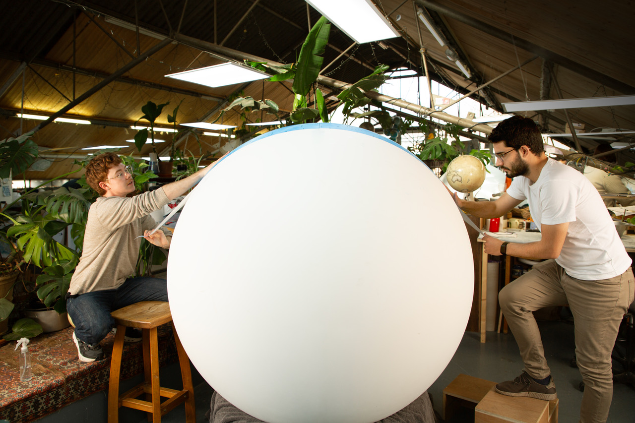
Stationary Mount
A type of mount that keeps the sphere and full meridian affixed to the globes base. We do not make any stationary mounts, all of our globes have some method of movement. We can do by request but it has never been requested!
Table Globe
A table top world globe is a scaled, spherical miniature model of Earth designed to sit securely on a flat surface like a desk, shelf, or table.
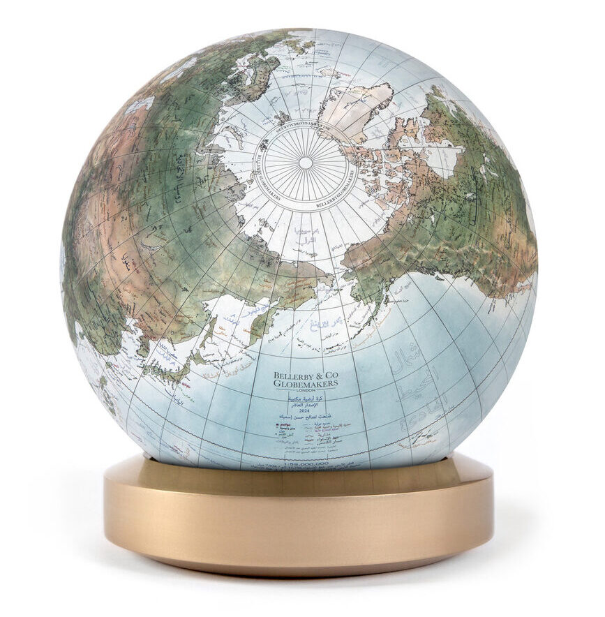
It typically rests on a dedicated stand (like our Livingstone) or a base that allows the sphere to rotate (like our Albion bases where the globes spin 360 degrees by hand on bearings).
Standard tabletop models usually range from 12cm to 36cm in diameter, though we also get commissions for larger desktop globes ranging from 50cm to 80cm diameter as well.
Table top globes are wonderful aesthetic pieces for homes, classrooms, and offices. Styles range from classic with an antique feel to to modern with use of colour and metals.
Pictured : above is a 22cm Mini Desk Globe with a Bronze base and Gagarin colouring, below is a 50cm diameter Regency Blue Albion with a Walnut Wood base.
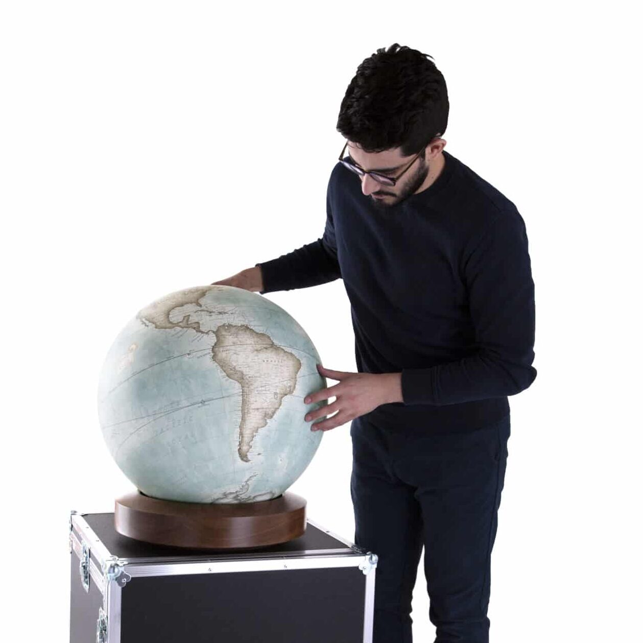
Terrestrial Globe
A terrestrial globe is a three-dimensional, spherical scale model of Earth.
Unlike flat maps, which stretch or distort Earth’s surface when projecting a sphere onto a 2D plane, a globe preserves true proportions, shapes, and spatial relationships between landmasses and oceans.
Terrestrial Globes display oceans, continents, countries, major cities, and geographic reference lines like the equator, meridians (longitude), and parallels (latitude).
Differs and customarily pairs with a Celestial Globe which maps the visible stars, constellations, and astronomical objects on the celestial sphere.
Three-dimensional
Having the appearance of width, height, and depth.
Most maps are static two-dimensional (2d), geometrically accurate (or approximately accurate) representations of three-dimensional (3d) space. Globes are three-dimensional.
Time Dial
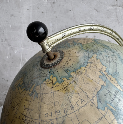 A time dial on a world globe is a small, rotating circular disc—usually placed at the North Pole—divided into 24 equal segments representing the hours of the day and night. Not commonly part of world globe designs in modern times, more often seen on factory made vintage American globes.
• The disc is marked with 24 hours (often showing AM and PM or a 24-hour format) and aligns with the longitude meridians running down the globe.
• You rotate the dial so a known local time lines up with a specific meridian or city. You can then look at any other meridian on the globe to read the comparative local time for that region.
• If you rotate the dial to align 1:00 PM with the meridian running through New York, you can look across the dial to the Prime Meridian (London) and see that it is 6:00 PM.
Western Hemisphere
The Western Hemisphere is the half of Earth that lies west of the Prime Meridian and east of the 180th meridian.
• The Americas: all of North America, Central America, South America, and the Caribbean islands.
• Other Regions: Portions of western Europe, western Africa, Antarctica, and eastern Russia.
• Oceans: Large parts of the Atlantic Ocean and the Pacific Ocean.
• Geographical Definition: longitude lines (0° to 180° W). Some maps use 20° W and 160° E so that Europe and Africa are not split in half.
Zodiac
On a world globe, the zodiac refers to the decorative band or calendar ring—often seen around the equator, across the oceans, or on the horizon meridian ring—showing the 12 astrological signs to track the sun’s apparent yearly path.
Celestial Tracking: maps the ecliptic (the sun’s yearly path across the sky) onto a terrestrial or dual-purpose (terrestrial-celestial) globe.
Historically, older or vintage globes used the zodiac ring to show which sign or constellation the sun was passing through during specific months and days of the year.
On many antique or vintage toy globes (like traditional Ohio Art metal globes), the 12 zodiac symbols are illustrated as an ornamental border around the map.